
Groundwater Resources

Groundwater – the lifeblood of the Hill Country
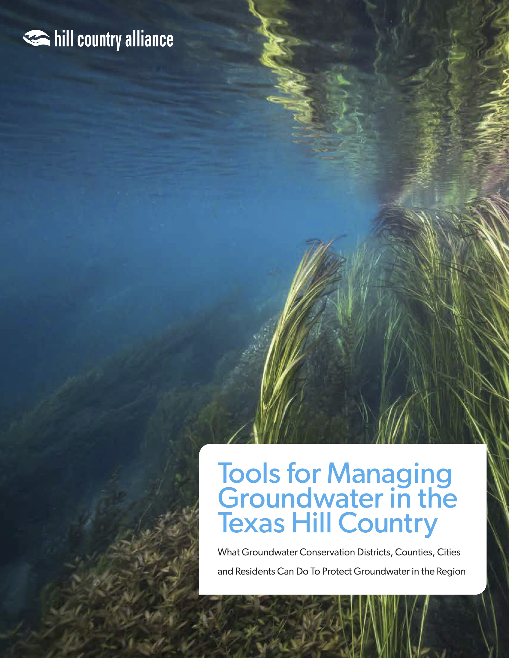
Groundwater is one of the most valuable resources in the Hill Country. Our underground aquifers provide water for homes, businesses and agriculture. Groundwater also serves as the reserve supply for future residents, since most aquifers do not recharge as quickly as we deplete them. Our aquifers are a vitally important source of water for the Hill Country’s hidden gems: our springs, small streams and creeks and clear running rivers. However, our groundwater supply is limited and under increasing pressure from a growing population. If this resource is to sustain our communities, future generations and the environmental treasures of the Hill Country, it must be carefully managed.
The Rule of Capture
In Texas, groundwater and surface water are governed separately. Surface water is owned and permitted by the state while groundwater is considered a private property right of a landowner. Governed by the Rule of Capture, commonly referred to as the “law of the biggest pump,” a landowner has absolute ownership of any captured groundwater with no liability for harm caused to neighbors or surrounding ecosystems.
Texas adopted the Rule in 1904, when aquifers and hydrogeology were poorly understood. Around this same time advances in well drilling technology and electricity brought on by the Industrial Revolution in the early 20th Century contributed to the widespread use of groundwater than ever before seen.
In recent decades, a number of legal cases challenging the Rule accompanied by periods of severe droughts has led many state officials and water managers to consider the consequences of unrestricted pumping. In 1949, the Texas Legislature established groundwater conservation districts (GCDs) as the only state entities allowed to regulate and thereby modify the Rule of Capture.
Groundwater Conservation Districts
Groundwater Conservation Districts (GCDs) are the only entities in place to protect our groundwater resources. The Texas Legislature, recognizing the need for groundwater management after multiple lawsuits challenging the Rule of Capture, adopted SB1 in 1997 which allowed for the creation of GCDs. Districts are tasked with the development of groundwater management plans, the adoption of rules regulating the spacing and production of wells, and monitoring aquifer conditions.
GCDs are statutorily mandated to balance aquifer protection with the right of landowners to extract groundwater. Ensuring our aquifers remain healthy and resilient given the diversity of seemingly competing interests is no easy endeavor. Learn more about GCD authority and the challenges they face here.
Glancing at the map below one will notice the prevalence of single-county GCDs. Since aquifers don’t follow or abide by political boundaries, a more regional approach to planning was needed.
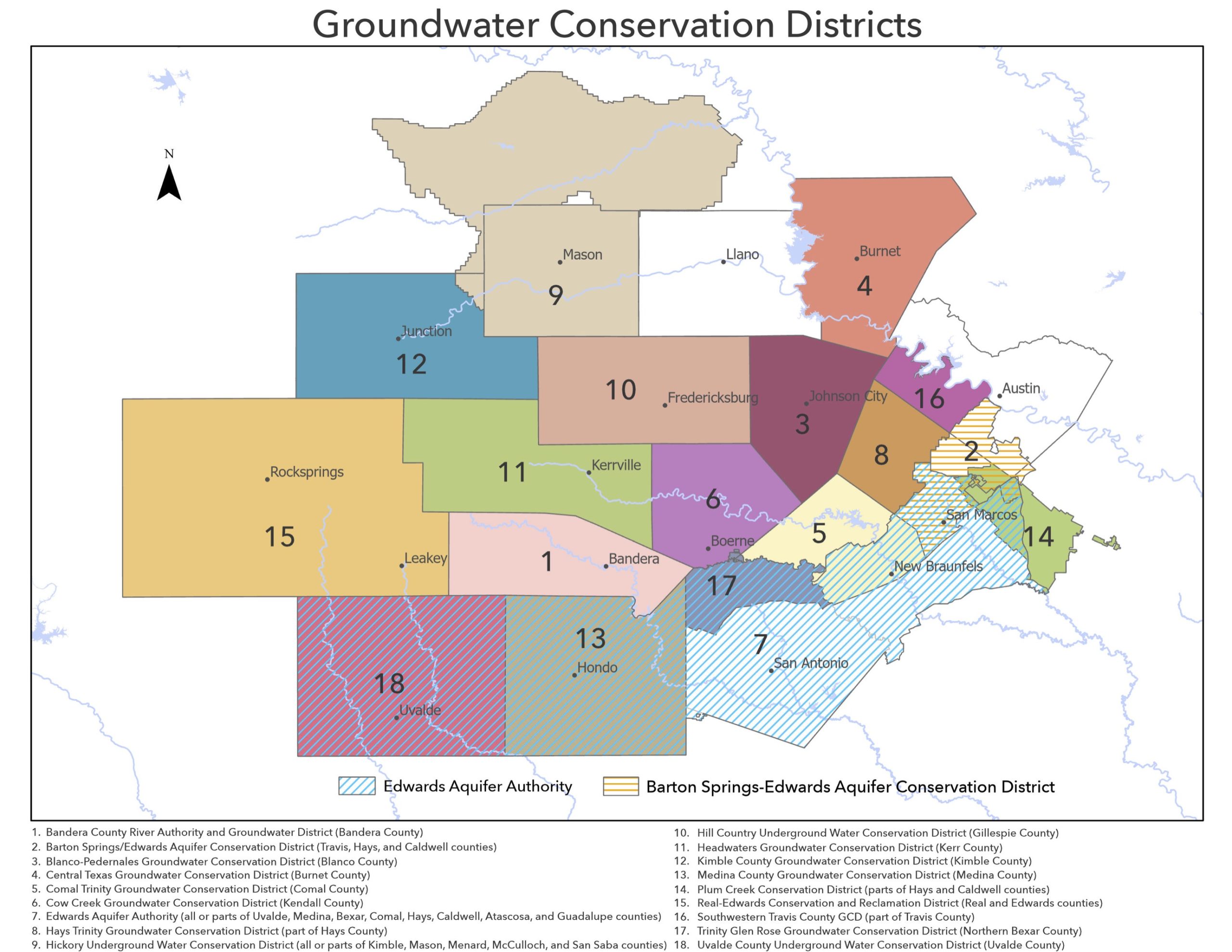
Map of Hill Country Groundwater Conservation Districts – updated in Spring 2023. Click to view full-size PDF.
Groundwater Management Areas
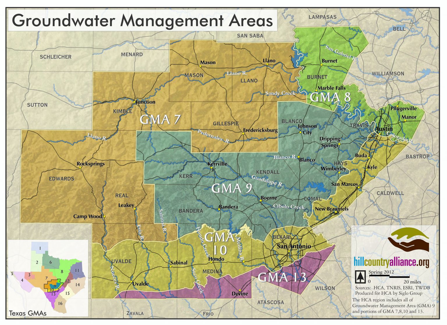
Groundwater Management Areas (GMAs) follow the outline of major aquifers better and require GCDs within the boundaries to coordinate and cooperate in regional planning. These GMAs are directed to come up with “desired future conditions” (DFCs) for the aquifers: they must agree upon how much water can and should be pumped now and in the future and how that pumping will affect the future state of the aquifer. Most often, the DFC is an average aquifer draw-down measured in feet. Some GCDs measure their DFCs as specific spring-flow rates. GMAs throughout the state will begin the second round of this process in the Fall of 2015, and the decisions they make will impact future generations.
Most of the Hill Country falls in GMA 9. GMA-9 member Groundwater Conservation Districts (GCDs) gather as a GMA to plan for the future of the Trinity Aquifer. GMA-7 in the western Hill Country plans primarily for the Edwards Plateau Aquifer. GMA-10 in the south and eastern Hill Country plans primarily for the future of the Edwards Balcones Fault Zone Aquifer.
A complicating factor to groundwater management is that most major aquifers overlap and there are several minor aquifers that are relevant for regional planning as well. For these reasons, some GCDs are in more than one GMA and must participate in multiple distinct regional planning processes.
Recent Water Resources News
Hill Country rivers at risk of historic lows ahead of tubing season
"In general, the Edwards Aquifer and San Marcos springflow levels are currently at levels that have only been experienced less than 10% of the time in recorded monitoring history and approaching the lowest levels on record for this time of year," Enders said in an...
Texas utilities are storing their water underground. Here’s why.
Among the most striking signs of Central Texas' ongoing drought are two of the region’s reservoirs: Canyon Lake in Comal County and Medina Lake, west of San Antonio. In both lakes, the water levels are historically low. For the first time since it was filled in the...
Protect the Pedernales: The dangers of discharge
The Pedernales River is one of Texas’s most cherished waterways, an ecological, recreational and cultural treasure that defines the Hill Country. As stewards of this vital resource, the Pedernales River Alliance (PRA) has opposed the wastewater permit application...
An EPA rule will reduce lead in drinking water—Unless this effort to block it succeeds
A landmark Environmental Protection Agency rule enacted at the end of last year sought to address the lead crisis—which threatens the health of millions of Americans—by tightening limitations on toxic lead and copper in drinking water. But that might not be the final...