
Water Planning

Water Planning
Where our future water supply will come from and how and where it will be used will have significant effects on the Hill Country’s quality of life. Our creeks and streams are an undeniable part of the Hill Country’s heritage. Because so many of these surface water features are directly connected to groundwater sources (aquifers), accounting for groundwater supplies, surface water supplies and human needs through sound water planning is essential to protecting and maintaining the historical qualities of the land.
The state water planning process is designed to incorporate expertise developed at the local level. River authorities plan for future surface water needs, and local Groundwater Conservation Districts (GCDs) do significant work in estimating and planning for future groundwater availability based on long term population projections. Texas accomplishes statewide water planning through two grass-roots regional planning systems.
- Regional Groundwater Planning: Each major aquifer has a regional groundwater planning group made up of member groundwater conservation districts (GCD) called a Groundwater Management Area (GMA). The Hill Country is largely covered by GMA 7, 9, and 10. GMAs meet to plan for whole aquifer management and to set future conditions of the aquifers that they are responsible for managing. Those plans represent the locally decided desired future conditions (DFC) of area aquifers. You can find a more thorough explanation of that process on our Groundwater Resources page.
- Whole-system water planning is based geographically on river basins and is carried out by Regional Water Planning Groups (RWPG). Each region is represented by a group of local stakeholders and aquifer managers who develop a written plan that accounts for water needs, supplies and strategies to develop new sources of water where future shortages are expected. These plans are reviewed by the Texas Water Development Board, the state agency responsible for water supply planning, and are consolidated into the State Water Plan.
The state is also in the process of implementing a new planning process for environmental flows developed under SB 3, a bill passed in 2007. The environmental flows process is designed to provide science-based standards for fresh water levels required to sustain healthy ecosystems in the state’s river basins and estuaries. Final standards will ultimately be set by TCEQ rule.
Get to know what Regional Water Planning Group (RWPG) you live in
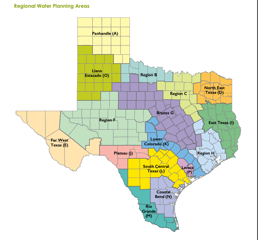 Planning occurs on a five year rotating cycle with a 50-year outlook. Regional planning groups have completed their regional water plans and they have been integrated into the draft 2022 State Water Plan. The Hill Country includes portions of planning regions F, J, K and L.
The Regional Water Planning Groups have completed their plans and they have been included into the 2022 State Water Plan.
The public is encouraged to make comment on future State Water Plans. These comments will be considered and voted on for inclusion and implementation in the next planning cycle by the Regional Water Planning Groups.
2016 HCA Public Comments to the Hill Country’s Regional Water Planning Groups
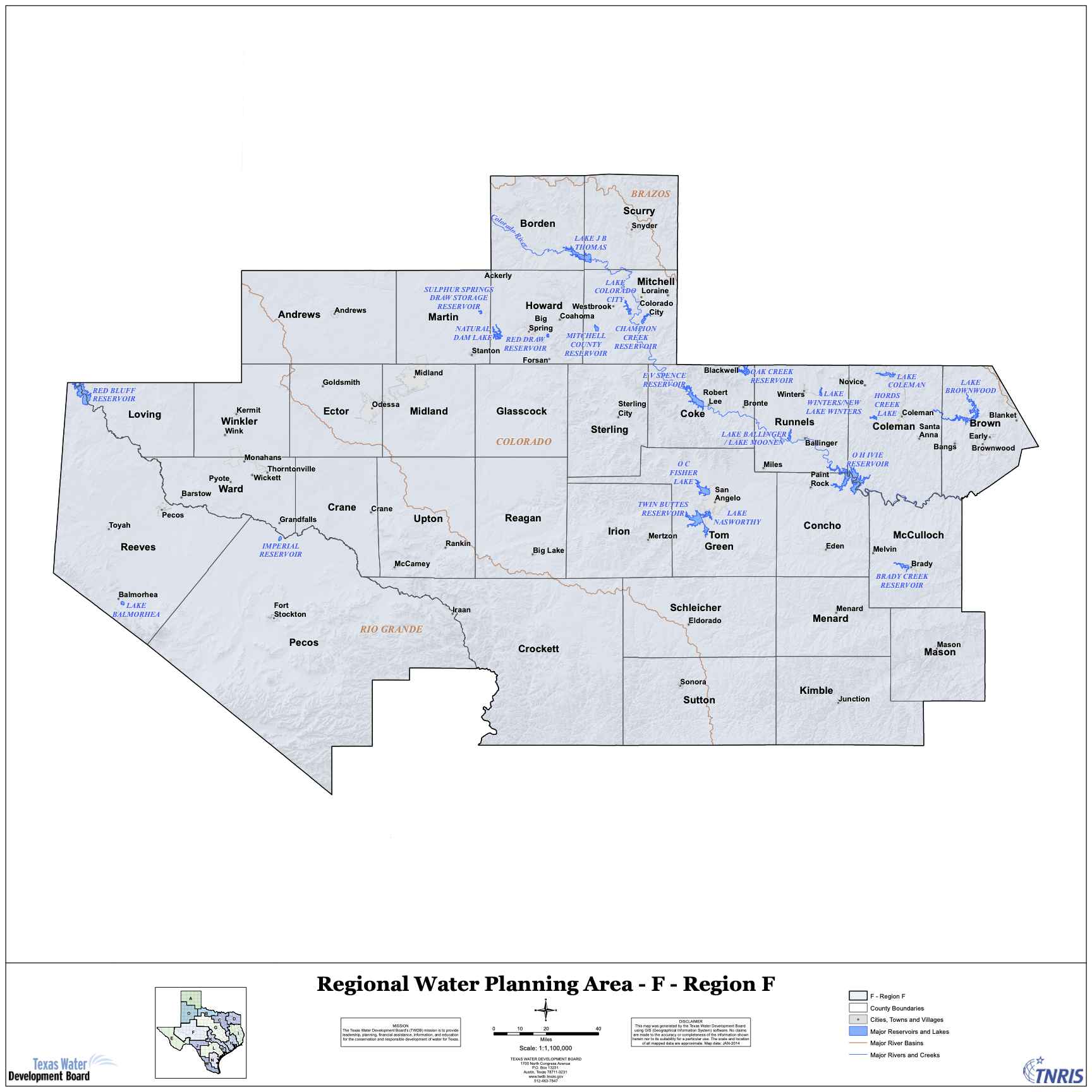
Region F: Upper Colorado and Pecos River Basins
The Region F water planning region includes 32 counties in western Texas. The largest cities in the region are Midland, Odessa and San Angelo. Most of Region F lies in the Upper Colorado River Basin and the Pecos River Basin. While surface water provides much of the municipal supplies, groundwater provides the majority of the water to the region and includes four major aquifers and seven minor aquifers.
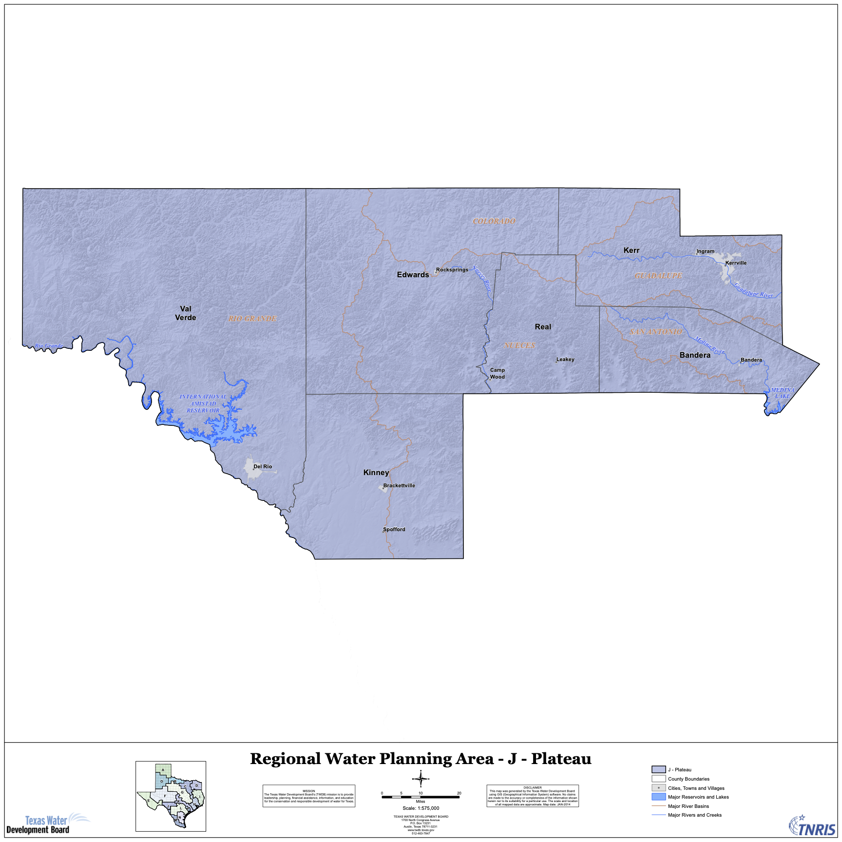
Region J: Plateau Regional Water Planning Group
Stretching from the Central Texas Hill Country westward to the Rio Grande, the Plateau Water Planning Group region is located along the southern boundary of the Edwards Plateau and includes Bandera, Edwards, Kerr, Kinney, Real and Val Verde Counties. The Region hosts part of five major River Basins (Rio Grande, Nueces, San Antonio, Colorado and Guadalupe) and their spring-fed tributaries. While underground, the Region is served by three major (Edwards-Trinity Plateau, Edwards BFZ, and Trinity) and several minor aquifers.
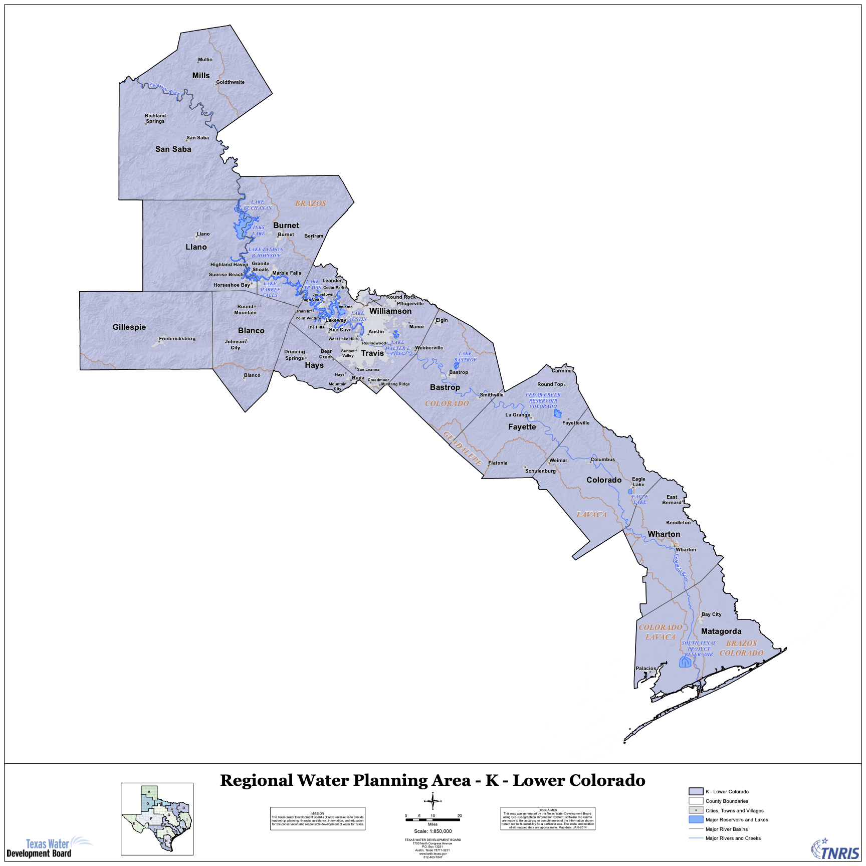
Region K: Lower Colorado Regional Water Planning Group
The Lower Colorado Regional Water Planning Area is composed of all or parts of 14 counties, stretching from Mills County in the Hill Country southeast to the Texas Gulf Coast. The Lower Colorado River Authority (LCRA) is the administrative agent for Region K. Region K has 25 regular members representing many interest groups who are responsible for developing and refining the long-range water plan for the Central Texas region. View the current Region K member list.
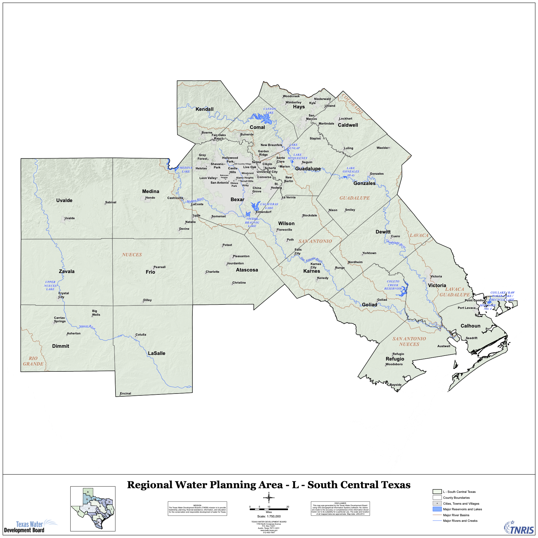
Region L: South Central Texas Regional Water Planning Group
The purpose of the South Central Texas Regional Water Planning Group (SCTRWPG), Region L, is to provide comprehensive regional water planning and to carry out the related responsibilities placed on regional water planning groups by state law. Foremost among those responsibilities is the development of a regional water plan for the planning area. The plan identifies both short and long-term water supply needs and recommends water management strategies for addressing them. The plan is updated every five years.
Current and proposed water transfer projects affecting the Hill Country
There are numerous existing and proposed water plans that call for transfers of water from one area to another. Hydrologists recognize the economic and ecologic perils of de-watering one region to satisfy the desires of another. There are proven examples of unregulated sprawl generated by externally sourced water supplies. Unregulated sprawl creates a variety of stresses that put the Hill Country’s clean rivers and aquifers at risk.
The Myth: Surface water pipelines can supply growth while protecting springs and failing wells.
In the early 2000s, the LCRA was in wholesale water expansion mode. Declining Trinity Aquifer levels in the Dripping Springs area effectively limited development and Hays County developers needed more water to fuel growth. LCRA proposed a pipeline from Lake Travis along US-290 West to Dripping Springs in order to serve the growing Northern Hays County corridor with water.
That controversial pipeline was promoted to the public as water source that would allow growth in the Dripping Springs area while decreasing pumping from the over-burdened Trinity Aquifer — and its rapidly declining springs and wells.
The Reality: Growth allowed by the pipeline’s water infusion has resulted in an increase of unregulated Trinity Aquifer pumping from over 3.5-million gallons per year in 2002 to almost 88-million gallons per year in 2014 – a 2354.54% increase. Aquifer mining will likely continue to increase at ever higher rates as development continues and the pipeline’s capacity is maximized. Read the complete study here.
One controversial project is the San Antonio Water System’s $3.4 Billion SAWS/Vista Ridge Pipeline Project which proposes to pump almost 16.3 billion gallons of water per year from the Carrizo-Wilcox Aquifer underneath Burleson County to northwest San Antonio. Read more here
Recent Water Planning News
Hill Country rivers at risk of historic lows ahead of tubing season
"In general, the Edwards Aquifer and San Marcos springflow levels are currently at levels that have only been experienced less than 10% of the time in recorded monitoring history and approaching the lowest levels on record for this time of year," Enders said in an...
Texas utilities are storing their water underground. Here’s why.
Among the most striking signs of Central Texas' ongoing drought are two of the region’s reservoirs: Canyon Lake in Comal County and Medina Lake, west of San Antonio. In both lakes, the water levels are historically low. For the first time since it was filled in the...
Protect the Pedernales: The dangers of discharge
The Pedernales River is one of Texas’s most cherished waterways, an ecological, recreational and cultural treasure that defines the Hill Country. As stewards of this vital resource, the Pedernales River Alliance (PRA) has opposed the wastewater permit application...
Texas lawmaker files bill to reduce “forever chemicals” in sewage-based fertilizer
Johnson County’s newest state representative, Helen Kerwin, R-Cleburne, filed her first bill Friday targeting an environmental problem that has struck her county: PFAS contamination in sewage sludge-based fertilizers. Kerwin said House Bill 1674, could reduce the...