
CBSL Test

The Lone Star State’s First Sentinel Landscape Designation
The Camp Bullis Sentinel Landscape Consortium is a partnership focused on conserving natural resources, strengthening military readiness, and bolstering agricultural productivity around Joint Base San Antonio-Camp Bullis.
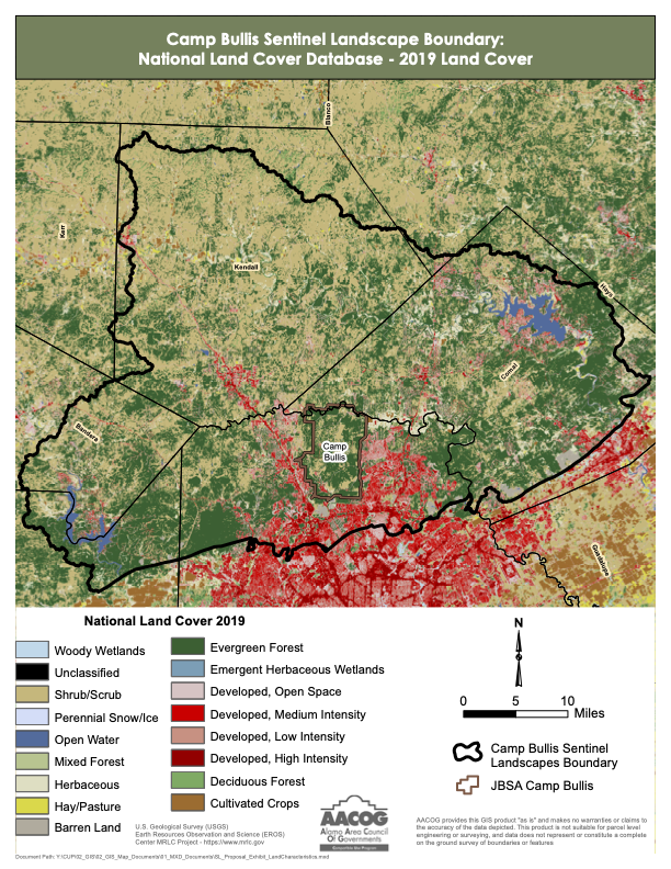
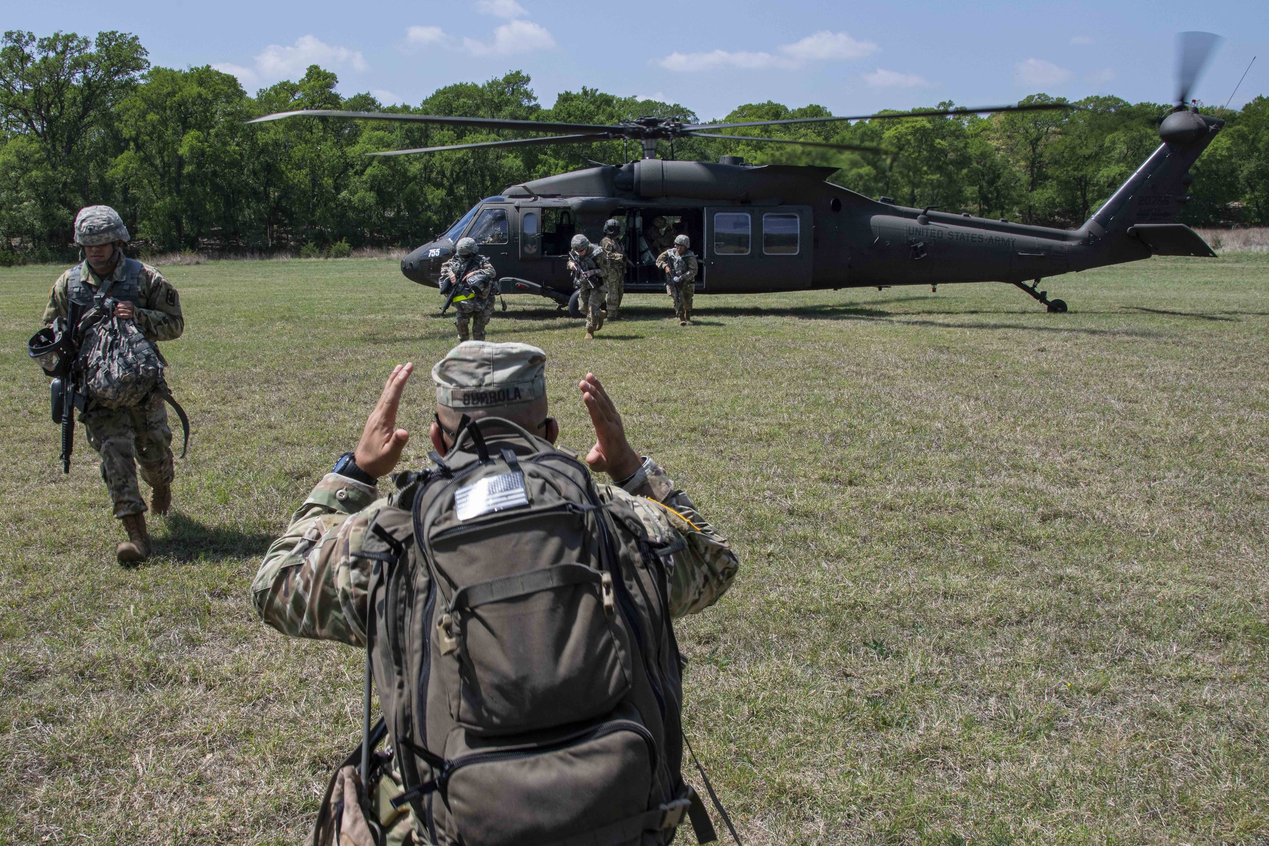
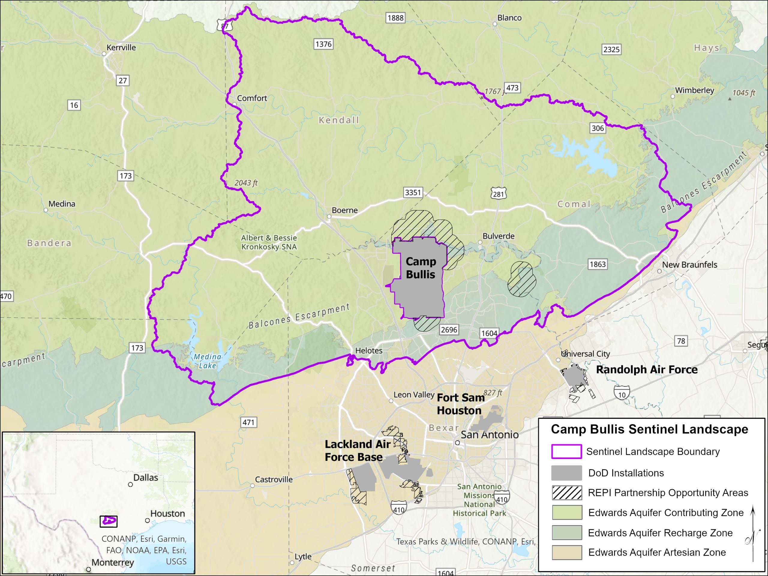
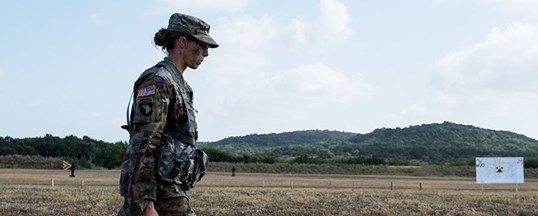
Camp Bullis is located in northern Bexar County on the Edwards Aquifer Recharge and Contributing Zones. Here, Joint Base San Antonio (JBSA) provides training opportunities for 266 mission partners; this includes supporting all Department of Defense (DoD) enlisted and officer medical training, military intelligence, special forces, pre-deployment, national, and international training requirements.

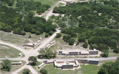
Camp Bullis Military Training Reservation is a U.S. Army training camp comprising more than 27,000 acres in Bexar County, Texas, just northwest of San Antonio. – Joint Base San Antonio
With rapid population growth emanating from San Antonio and the I-35 corridor, the Texas Hill Country and Camp Bullis Sentinel Landscape (CBSL) are facing a mounting number of challenges affecting the long-term resilience of the region’s natural resources. New development contributes to the loss of agricultural lands and increased ambient light pollution, impacting nighttime military training. Growing demands on existing water supply have led to the loss of spring flow and aquifer drawdowns, impacting drinking water supplies for Camp Bullis, rural landowners, towns, and cities.
These and other challenges have attracted a myriad of partners to come together to create a collective vision for how to invest in protecting the natural resources that define the region as it grows. Since 2021, HCA has coordinated this collaborative effort, engaging dozens of partner organizations to collaborate towards shared goals.
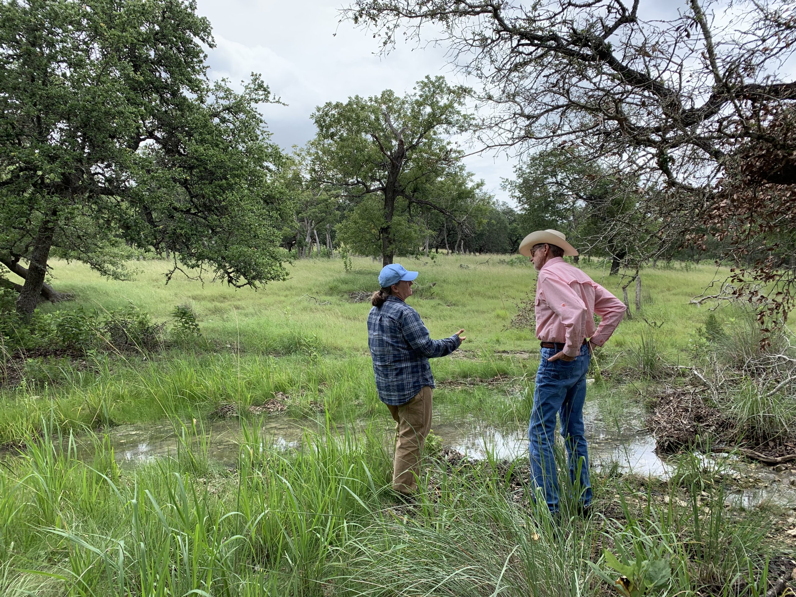
Collaborative work will especially focus on supporting private landowners with resources that align with their stewardship goals. Thoughtful land stewardship provides rippling benefits, not only for the private landowner, but for society and future generations. Good land stewardship enhances water quality and quantity, mitigates floods and drought, supports agricultural productivity, and improves wildlife habitat.
The Consortium will also work to address regional challenges and opportunities, including: reducing light pollution that impairs nighttime training capabilities at Camp Bullis; mitigating wildfire risks to the military installation and nearby communities; and expanding access to public recreation areas.
Learn More
Video: A New Frontier in Public-Private Land Conservation and Stewardship
In this 7-minute recording from the 2021 Hill Country Leadership Summit, HCA’s Land Program Manager Daniel Oppenheimer presents a new project to advance collaborative conservation in the southern Hill Country.
Consortium Partners
This work is made possible through ongoing collaboration between more than 30 partners across the region. Consortium partners are divided into two categories – signatory partners are charter members that signed a memorandum; supporting organizations are part of the core team and have invested significant time in the project.
- Alamo Area Council of Governments
- Alamo Resource Conservation & Development Area, Inc.
- Bexar Audubon Society
- Cibolo Center for Conservation
- Cibolo Conservancy
- City of San Antonio
- Comal County Conservation Alliance
- Cow Creek Groundwater Conservation District
- Edwards Aquifer Authority
- Edwards Aquifer Conservancy
- Great Springs Project
- Greater Edwards Aquifer Alliance
- Hill Country Alliance
- Joint Base San Antonio
- San Antonio River Authority
- Texas A&M – Natural Resources Institute
- Texas Wildlife Association
- Trinity Glen Rose Groundwater Conservation District
- US Fish & Wildlife Service
- DOI National Park Service – Rivers, Trails & Conservation Assistance
- Federal Emergency Management Agency, Region 6
- Green Spaces Alliance
- Guadalupe Blanco River Trust
- Kendall County Soil & Water Conservation District
- San Antonio Board of Realtors
- San Antonio Chamber of Commerce
- San Antonio Hispanic Chamber of Commerce
- Texas Agricultural Land Trust
- Texas Division of Emergency Management
- Texas Military Department
- Texas Military Preparedness Commission
- Texas Parks & Wildlife Department
- Texas State Soil & Water Conservation Board
- Texas State University – Meadow Center for Water and the Environment
- The Nature Conservancy
- University of Texas – San Antonio
- USDA Natural Resources Conservation Service
- US Army Corps of Engineers
Maps and Photos
Additional Related News
AACOG-led consortium seeks Sentinel Landscape status for JBSA-Camp Bullis
Joint Base San Antonio-Camp Bullis sits astride the Southern Edwards Plateau on the Northwest edge of San...