by admin | Apr 2, 2020 | Groundwater Resources, Legislature and Regulation, News, Oil and Gas Pipelines, Planning and Development, Scenic Beauty, Water Quality, Water Resources
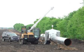
Residents in Blanco County a mile or so upstream of where the Kinder Morgans Permian Highway Pipeline (PHP) crossed the Blanco River are reporting brown tap water coming from their wells. One of them, who lives off FM 165 about a mile from the Chimney Valley Road...
by admin | Apr 1, 2020 | Aggregate Production Operations, Groundwater Resources, Land Conservation and Stewardship, Landowner Alliances, Legislature and Regulation, News, Planning and Development, Regional Planning, Water Catchment Areas (Watershed), Water Planning, Water Quality, Water Resources
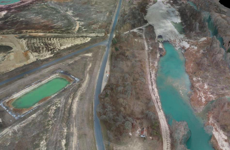
Having nearly exhausted its exploitation of the Guadalupe River quarries from Comfort to Center Point in Kerr County, the sand, gravel and aggregate industry (APOs) is actively pursuing possible sites in the floodplain areas of Kendall County. Largely...
by admin | Mar 30, 2020 | Economics of Sound Planning, Groundwater Resources, Land Conservation and Stewardship, Land Stewardship, Legislature and Regulation, Native Landscapes, News, Planning and Development, Scenic Beauty, Water Conservation, Water Resources, Wildlife
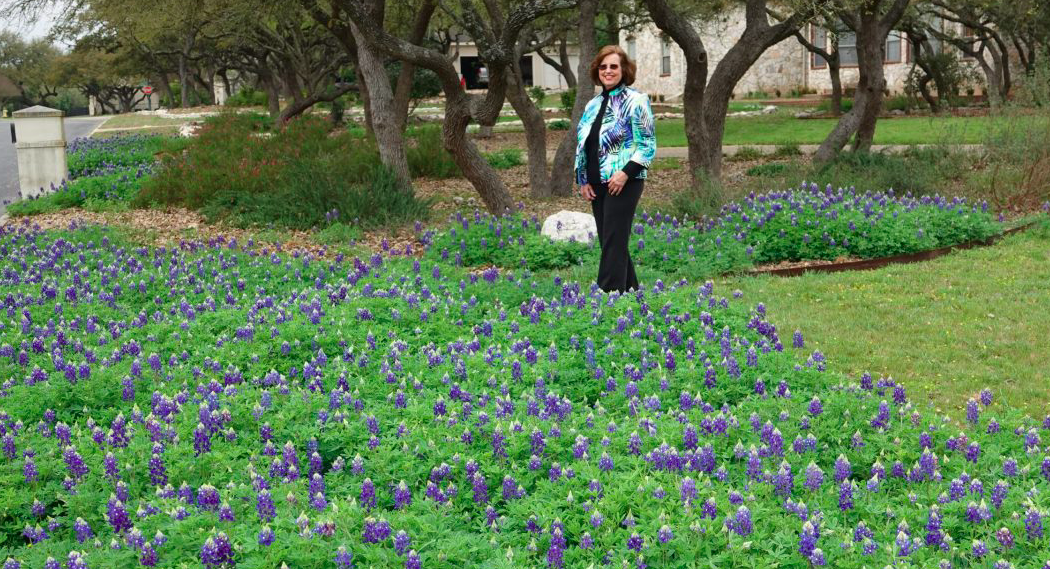
San Antonio Water System (SAWS) has long offered incentives to homeowners to replace non-native grass lawns with drought-resistant native plants. But the city’s many homeowner associations (HOAs) continue to favor water-thirsty, non-native turf grasses and resist...
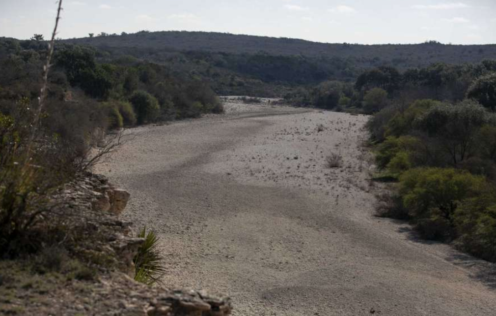
by admin | Mar 25, 2020 | Drought, Groundwater Resources, News, Scenic Beauty, Water Catchment Areas (Watershed), Water Conservation, Water Planning, Water Resources
On March 5, 2020, the Hays Trinity Groundwater Conservation District Board of Directors passed a new rule—Rule 15, Jacob’s Well Groundwater Management Zone—to better protect water resources and springflow during drought. This action comes in response to community...
by admin | Mar 19, 2020 | Groundwater Resources, News, Planning and Development, Water Catchment Areas (Watershed), Water Planning, Water Resources
The total Edwards Aquifer watershed north of San Antonio is 2.5 million acres, composed of 2 million acres in the Contributing Zone and 500,000 acres in the Recharge Zone. To protect the total watershed, we must protect land and water in both zones, not just one of...
by admin | Mar 3, 2020 | Conservation Easements, Economics of Sound Planning, Groundwater Resources, Habitat Conservation Plans, Land Conservation and Stewardship, Land Stewardship, Landowner Alliances, Low Impact & Sustainable Development, News, Planning and Development, Regional Planning, Scenic Beauty, Water Catchment Areas (Watershed), Water Conservation, Water Planning, Water Resources
Taxpayers have spent $260 million to protect the Edwards Aquifer. With the tax set to expire, officials can’t agree on how much more to spend. The Frio River snaked south through the hills of Uvalde County, its clear waters coursing over a bed of white, fractured...